| Wildlife Conservation in Botswana |
|
[Last updated: 02-Aug-2020]
| Start | | | Week 1 | | | Week 2 | | | Week 3 | | | Week 4 | | | Week 5 | | | Week 6 |
The thunderstorms during the night came to nothing; Sunday morning was fresh and sunny.
At 13:30, after lunch, Jens, Esteban and I set off for the Limpopo River (again), as we did yesterday. However, we had a few additional passengers: three members of Sophie's family (who were visiting the camp for a few days' holiday). Jens and Esteban wanted to do some fishing; I went along for the ride (and to take some photographs). Along the route, we saw a small herd of elephants under a tree, sheltering from the hot sun (Photo BW-110). We also passed a couple of zebras (Photo BW-111).
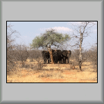 Photo BW-110 |
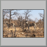 Photo BW-111 |
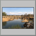 Photo BW-112 |
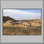 Photo BW-113 |
At our destination, the 'girls' went off for a walk, while we 'boys' walked to a large Limpopo River rock pool (Photo BW-112), to do some fishing; the pool was a few hundred metres from where we had yesterday's picnic. After preparing their hooks, Jens and Esteban cast their fishing lines and waited.
Esteban's line twitched first and he reeled in a small fish. Unfortunately, instead on being in the fish's mouth, the hook had somehow attached itself to a part of the fish's head; not very nice to see! Two minutes after casting again, Esteban had another bite. This time, the resistance was much greater, and he called Jens over to help. It was obvious that this fish was a lot bigger than the last one. We all moved to another part of the pool where Jens attempted to weaken the (unknown) fish, while still bringing it closer to the bank. At one point, the fish (it looked like a catfish) was half-way out of the water, when the fishing line snapped! That was the one that got away! All this was captured on video. Jens also had a bite some minutes later, but (again) was unable to land it.

The One (or Two) that got Away
[7 minutes, 21 seconds]
While the fishing was going on, I saw two beautifully coloured birds on the opposite bank: a European Bee-eater and a White-crowned Lapwing, also known as a White-crowned Plover.
Soon after all this excitement, the girls appeared from their walk. We packed up and all returned to the Land Cruiser for our journey back to the camp.
By the time we arrived back at camp, the wind had picked up considerably. So much so, I felt cold, even though the temperature was 25°C! The evening's sunset (captured in the following four photos, between 16:44 and 17:54) looked threatening, similar to last night, but again, nothing came of it. Because I felt cold, I retired to my tent (to be out of the wind), once the house-keeping activity (cleaning of the dishes) had been completed.
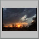 Photo BW-114 |
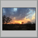 Photo BW-115 |
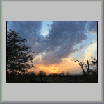 Photo BW-116 |
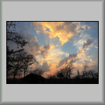 Photo BW-117 |
Today's two projects: Spoor (Footprint) Identification, and Pole and Wire Removal.
Jo took us (four volunteers and Sophie's family) to the Limpopo River (for the third day in a row) to hunt down cat footprints. En route, we saw lots of Helmeted Guineafowl, Wildebeest (Gnu), Kudus and Impalas. The only footrints we saw were those belonging to Hyenas and the African Civet. It was fortuitous that we went to the river, as we saw four crocodiles; two of which were 'large'! I didn't know it at the time I took Photo BW118, but what I thought was just a felled tree trunk (in front of the trees on the far bank, close to the water's edge) was later identified, with binoculars, as being one of those two large crocodiles!
For the afternoon's Pole and Wire Removal activity, we worked our way along the cut line; see Photo 119.
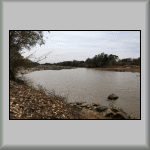 Photo BW-118 |
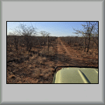 Photo BW-119 |
Today's two projects: Road Cleaning and a Mammal Census.
There's nothing to report here (because I didn't make any notes), except the start, middle and finish GPS co-ordinates: S22°18'37.44" E28°50'43.86", S22°17'30.00" E28°49'51.54" and S22°16'17.58 E 28°50'43.86" respectively.
While we were away from the camp, the afternoon's Mammal Census had been changed in favour of a Baobab Tree Census, but it changed yet again some time later! After having finished eating lunch, Helena arrived at the camp at 12:20. The bush was on fire! Would we help to put it out? There was only one unanimous answer to that! So at 12:45, all available hands left the camp and headed for the flames! We could see in which direction we needed go, from the rising smoke (Photo BW-120). But to get a better idea of where it was, and how to get to it, we climbed a koppie/kopje for a better view (Photo BW-121).
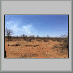 Photo BW-120 |
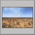 Photo BW-121 |
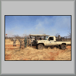 Photo BW-122 |
When we arrived close to the fire, we were met by a team from the Limpopo Lipadi Reserve (Photo BW-122). Once discussions had taken place (about what needed to be done, and where), it was time to grab either a shovel (to smother the flames with dirt and/or sand) or a machete (to cut branches to use as flame beaters).
The discussions were on-going (Photo BW-123)! They had to be, because no sooner had burning grass been extinguished in one place, it would reignite shortly after, a few metres away, by the wind fanning glowing embers, or blowing sparks onto unburnt grassy areas (Photo BW-124). Even though burnt areas (Photo BW-125) can appear to be free from flames, they can still burst into flame from nearby smouldering areas (Photo BW-126); even when we needed to stop to breathe fresh air (Photo BW-127)! Towards the end of the afternoon, we watched (Photo BW-128) as the last few flames were put out. Despite the destruction, some scenes were worth photographing (Photo BW-129)!
At the end of the day, it was time to regroup and head for home (Photo BW-130).
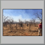 Photo BW-123 |
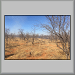 Photo BW-124 |
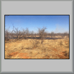 Photo BW-125 |
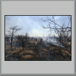 Photo BW-126 |
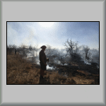 Photo BW-127 |
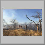 Photo BW-128 |
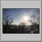 Photo BW-129 |
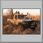 Photo BW-130 |
I had never seen or experienced anything like today. Being so dry, I didn't realise that the grass can be as highly inflammable as it was! At one point, we battled with the flames to stop them crossing the vehicle track; and to keep our exit route clear! We thought we had succeeded in putting out the fire, but when a gust of wind blew, sparks jumped across the track and ignited the tinder-dry grass on the other side of the track! Through being persistent, we eventually extinguished all flames at that location, thus safeguarding our exit from the area!
We arrived back at Motswiri at 18:45, hungry (ready for dinner), tired,
dirty and smelling of smoke.
Wednesday, 05-Oct-2016
Today's two projects: Wire Removal and a Baobab Tree Census.
The first activity started at GPS location S22°20'16.80" E28°50'52.80"; see the location (in Google Earth), where fence wire was retrieved. By the way, on one of our activities a few weeks ago, we came across Daniel and his men demolishing the waterhole (at the final location point). The next paragraph explains the reason why.
The afternoon's Baobab Tree Census was to take place on the Sukses property, but before starting the census, Jo drove us to the Pink House (overlooking the Limpopo River) to see how its demolition was progressing. It is a shame that such a nice building was being demolished (again by Daniel and his men), especially at such a lovely location. But the owner wanted to restore his property to its original condition; which I now understand is the right thing to do. We stayed about half an hour, and then left to measure four nearby baobab trees, the first, of which, can be seen in Photo BW-131; see Week 2 to know how these trees are measured.
[The Danish troublemaker was involved in yet another argument; this time with Jo (who looked rather upset afterwards)! True to his colours, the Danish child stopped working and went and sulked in the truck! Oh, what a big baby!]
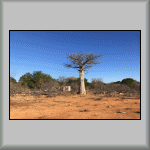 Photo BW-131 |
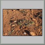 Photo BW-132 |
The rain that had fallen four days ago had already started having an effect. Small green shoots were appearing, giving the whole area a slightly green hue; Photo BW-132. It is quite remarkable that such little rain could have such an impact on life! I would like to have seen what the ground looked like when everything was in bloom.
On our return to the camp, a column of smoke could be seen in the same
area as yesterday's fire. Although he tried many times (on the radio and
phone), Jo was unfortunately unable to make contact with either Jens or
Judi, so there was nothing we could do.
Thursday, 06-Oct-2016
Today's two projects: Anti-Poaching and an Evening Mammal Census.
Jo drove Caroline and I to four waterholes. Poachers position and set snares near to where animals drink. Fortunately, we didn't find any. Three of the waterholes were alongside the tarmac road and the fourth was on the Mopane Property, beside a wind-powered water pump (Photo BW-133), which appeared to have a broken wind vane.
On our way back, travelling along the 'new' road, we met Judi travelling in the opposite direction. We stopped and discussed yesterday's bush fire. She happily informed us that it was under control.
After lunch, everyone appeared to retire to their respective tents for a bit of sleep. I, on the other hand, thought it was a good time to make another walking video tour of the camp site.
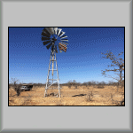 Photo BW-133 |

Motswiri Walking Tour
[7 minutes, 21 seconds]
At 17:30, we started the evening mammal census. Armed with torches and
warm clothes, we set off for the Sukses property. The animal that we most
wanted to see was a leopard, but it wasn't to be. We returned to the camp
at 22:00. In the darkness, the bush fire had obviously reignited, as we
could see flames burning!
Friday, 07-Oct-2016
Today's two projects: Dam Protection at the Hide and a Bird Census.
On my way to the kitchen for breakfast, I saw smoke in the direction of the bush fire. Sure enough, as with the previous few days, today's plans had to be changed. Overnight, the bush fire had intensified quite considerably! Thus, all hands were needed! So with shovels etc., it was back to where we were on Wednesday.
After helping put out a grass fire, I noticed a Leopard Tortoise (Photo BW-134) under a tree, about 3 metres from the edge of the burnt grass. [If you can't see the tortoise in Photo BW-134, look at Photo BW-135.] I left it where is was, thinking that it was safe; the grass fire had been put out. However, as I mentioned earlier this week, given the right conditions, the tinder-dry grass can reignite.
That is what happened here. Jens approached me about 10 minutes later and informed me that the grass had caught alight again, and unfortunately, took the life of the tortoise. I felt very sad, knowing that I could have saved its life!
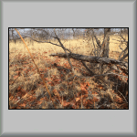 Photo BW-134 |
 Photo BW-135 |
The fire at this location was eventually completely extinguished. We then went to help another firefighting team, and were met by the scene shown in the following three photos.
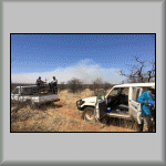 Photo BW-136 |
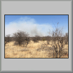 Photo BW-137 |
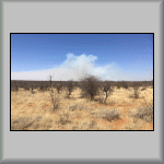 Photo BW-138 |
I don't remember what the exact time was (it seemed like a convenient point at the time), but we returned to the camp for lunch, after which, it was back firefighting in the afternoon. By the time we had returned to the fire scene, other helpers had arrived, which had a real impact (Photo BW-139), although there were fires still burning elsewhere (Photo BW-140)! So much so, that Judi lost a tyre! After parking her vehicle in what she thought was a safe place, the grass to the front it had ignited. Because of the heat, one of the tyres caught fire! Fortunately, no-one was injured.
The good news came later through everybody's determind efforts. The fire
was finally put out, and it was time for some liquid refreshment (out
of a coolbox)! I have to mention that Caroline said she didn't like beer.
But after I offered her my bottle, and she had taken a mouthful (or two),
she said it was the nicest beer she had ever tasted!
![]()
![]()
Although Photo BW-141 looks like another fire, it is actually the big one in the sky, not in the bush! On our way back to the camp, we noticed that one of the koppies/kopjes was on fire (Photo BW-142). However, it didn't seem to cause any concern to the guides, as they said it would eventually burn itself out. We arrived back at camp twenty minutes later, tired, hungry and dirty.
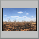 Photo BW-139 |
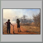 Photo BW-140 |
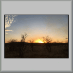 Photo BW-141 |
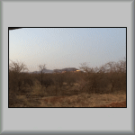 Photo BW-142 |
This morning's temperature was 22°C, with a strong wind!
Picnic Day! There was only one phone call received about the fire: It had been put out completely! Great news! Therefore, today's picnic was able to go ahead as planned.
Jo took us to have a close-up view of the effects of the Thune Dam. At the point where the original and new 'bypass' roads split, Jo chose to take the original road. A barricade of dirt had been created, but as can be seen in Photo BW-143, if someone wants to get around it, he/she will find a way! And so did we! We stopped a few metres from the water's edge (Photo BW-144) for a brief explore. The remainder of the original road can be seen directly opposite (the small white shape), on the other side of the reservoir.
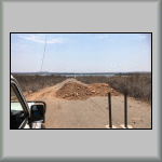 Photo BW-143 |
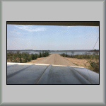 Photo BW-144 |
After splashing about for a bit (throwing and skimming the odd stone into and across the water!), we turned around and went back along the road for about 100 metres, turned off right, and stopped by the edge of a nearby lake (at GPS: S22°11'43.00" E28°39'53.20") for our picnic. We weren't alone; there were cows around the far side of the lake, with two Great White Pelicans and an African Spoonbill feeding on the lake.
After lunch, we packed up and returned to the bypass road, passing the koppie/kopje in Photo BW-145 and headed towards (and passed) the site of the Thune Dam. We turned around, and on our return, stopped on the bridge (over the Thune River (Photo BW-146)) and in front of the construction site (Photo BW-147), with both photos showing a view of the dam.
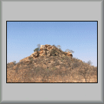 Photo BW-145 |
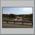 Photo BW-146 |
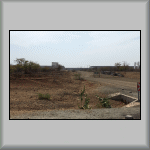 Photo BW-147 |
| Previous (Week 4) |
 |
Next (Week 6) |
Click to reveal a Home Page QR Symbol
![]()