| Wildlife Conservation in Botswana |
|
[Last updated: 01-Aug-2022]
| Start | | | Week 1 | | | Week 2 | | | Week 3 | | | Week 4 | | | Week 5 | | | Week 6 |
A few drops of rain were felt during the night, but that was all. At about 06:00, we could hear the call of the Crested Francolins over at the Motswiri camp. An hour later, due to the cold, we all packed up and returned to the camp, where we had some hot drinking chocolate! I then retired to my tent (in an attempt to warm up), until about 11:00.
Helena conducted a discussion workshop on animal conservation from 14:30 until 17:15. The day temperature had not risen sufficiently enough, so a few of us sat wrapped in blankets!
Caroline and I were the chefs for the evening. She prepared the salad while I made the bread dough for the Frankfurter sausages. We wrapped the sauages in the dough (which unfortunately didn't rise very much), and then cooked them over the camp fire. As it turned out, the result was quite acceptable. So, too, was the dessert: effectively, the same bread dough wrappped around pieces of Cadbury's Chocolate and cooked over the fire - ultimate baked bread rolls with melted chocolate centres; our version of Pain au Chocolat!
It was at this time that I felt the warmest in about 24 hours! I 'hit
the sack' at 21:00.
Monday, 19-Sep-2016
Today's two projects: A Bush Walk, and Fence Patrol and Repair.
We left the camp at 07:00, bound for the Suksess reserve, for a bush walk. However, apporximately 400 metres along the Tuli Reserves Road, we came across a lion and two lionesses lying in the road! As we approached, they moved into the bush (Photo BW-049) beside the road! Tyler was leaving at lunchtime and had previously said that he hadn't seen any lions during his time here. Well, we had heard the lions roaring during the past couple of nights, but today was his, and our, lucky day! We were all 'over the moon'! A truly Red Letter Day!
Three or four other cars came along the road (including one driven by Judi) and stopped to look, admire, and take photographs! It really was an incredible special moment!
In the time we were there, a number of photos were taken (Photos BW-049 to BW-054), together with two short videos - in portrait and landscape orientation respectively:
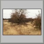 Photo BW-049 |
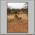 Photo BW-050 |
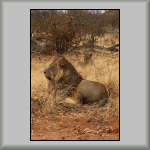 Photo BW-051 |
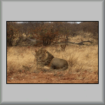 Photo BW-052 |
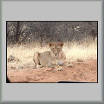 Photo BW-053 |
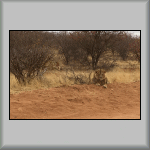 Photo BW-054 |
In both clips, it appears that one of the lionesses wanted the lion's attention (she was probably on heat?), but the lion wasn't interested. From what some heard, it is possible that he was exhausted after a busy night!
 Portrait Orientation [0 minutes, 33 seconds] |
 Landscape Orientation [0 minutes, 45 seconds] |
After this 'show of affection', the three lions walked behind our vehicle and crossed the road; see a closeup of the lioness (Photo BW-053) and the lion on the bank with one of the lionesses behind him (Photo BW-054).
We watched and admired these three big cats for about 45 minutes in total, before moving off onto the Sukses reserve for the bush walk. Dicks parked the Land Cruiser beside a koppie, from where we set off on foot.
Along the way, Dicks pointed out the different animal 'waste products' (Fr: caca); for example, we came across a pile of chalk-like white spheres. After picking one up and writing his name on a nearby rock, Dicks told us that it was the poo of a hyena; full of calcium - from the amount of bones that they eat. A little further on, he pointed to some bird nests in a Baobab tree. Most nests are constructed on the branches on the western side of trees; for the afternoon and evening sun! Knowing this, these nests provide a useful aid to navigation in the bush; absolutely amazing!
We made our way to the top of the koppie (from where Photo BW-055 was taken (GPS: S22°20'59.94" E28°53'56.40")) for a panoramic view.
From the high ground, we were able to watch kudus and elephants meander their way through the bush. That was the good news. The not-so-good news was when it was time to leave and return to the Land Cruiser. Our route was blocked by another herd of elephants!
Again, knowing the area, Dicks led us up to the safety of high ground, from where we watched two herds of elephants; one of which continued in our direction! Dicks thought that they could smell and hear us, but not see us; we being effectively hidden and protected by the rocks.
Our eventual route back to the Land Cruiser was via another koppie, in total silence! The knowledge of the bush that Dicks and Jo have is priceless! I'm pleased to say that Dicks got us safely back to the vehicle (Photo BW-056); at GPS: S22°21'5.30" E28°53'30.40".
 Photo BW-055 |
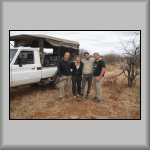 Photo BW-056 |
When we returned to the camp, we were introduced to a new volunteer from Denmark. Unfortunately, his luggage had gone "Walkabout", and so between us 'oldie' volunteers, we managed to help provide soap and toothpaste, and anything else that he required. Hindsight is a wonderful thing! If I had known what type of individual this lazy, good-for-nothing spoilt little brat-of-a-child was, I would never have helped him. He had a very big head on his small shoulders! [More about him later.]
Helena and Judi (the property owners) arrived just before lunch, very excited about seeing the big cats. Lunch was rice and lentils, with banana cake for dessert. Absolutely wonderful on a cold and windy day! Another wonderful event was seeing a herd of elephants pass the camp, just before we departed to the Mopane property, for the Fence Patrol and Repair activity.
Perimeter fences are erected for two reasons: 1) to protect and confine domestic animals (for example, cattle and goats) from predators, and 2) to prevent the wild animals from accessing the farmland - with the risk of possibly being shot!
Although perimeter fences (which are sometimes electrified) are between
2 and 3 metres high, they still get damaged by the animals they are trying
to protect. Damage ranges from bent posts (pushed over by elephants) to
gaps at the bottom of the fences (by animals 'burrowing' under the wire).
This afternoon's activity involved walking along a fence, looking for
damage. Where a bent piece could be straightened, it was. Where the bottom
of the fence had been damaged, or there was a gap, the repair process
involved filling the gap with soil and/or branches (cut from nearby trees).
This Google Earth view shows the stretch of fence
that was patrolled in a north-easterly direction, beginning at the tarmac
road (GPS: S22°15'13.14" E28°49'33.18").
Tuesday, 20-Sep-2016
Today's two projects: Anti-Poaching Patrol and a Baobab Tree Census.
This morning's anti-poaching route can be seen in Google Earth. During this exercise, one intact and unused wire snare was found near some animal bones. During our trek, we passed many signs that this was the dry season (Photo BW-057 and Photo BW-058).
The afternoon Baobab Tree census started well - for about the first 5 kilometres. Then, just past the point where we saw the lions yesterday, a nut on the left-front steering joint (of the Land Cruiser) worked itself loose and fell off, effectively immobilising the vehicle. We were stranded! Unfortunately, by this time of the day, the clouds had cleared, the sun was shining, and the heat had returned! I therefore crossed the road and sat in the (partial) shade of a bush, from where I took Photo BW-059.
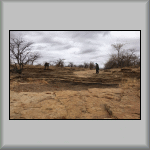 Photo BW-057 |
 Photo BW-058 |
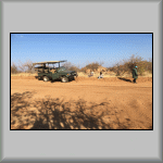 Photo BW-059 |
After spending some time searching the dirt road for the rogue nut (the 'needle in a haystack' syndrome) without any success, and unable to contact Dicks via the radio, Jo found a short length of fence wire within the vehicle and attempted to repair the steering joint. With the added assistance of a length of rope (cut from the canvas roof), he attempted (and successfully made) a very slow and careful drive back to the camp!
Shortly after arriving at the camp, Jo departed for a well-deserved holiday.
Wednesday, 21-Sep-2016
Today's two projects: The Dam Project and a Mammanl Census.
It was another cold morning (14°C), so there was a need to get physical to get (and stay) warm! Although the construction of the dam was complete, it was thought that there was too much sand around the dam. So, with shovels at the ready, we divided into two teams: one shovelled sand over the dam (making the reservoir side of the dam deeper) and the other team shovelled dirt and sand into the back of Sophie's truck. Its cargo was then transported a couple of hundred metres away from the dam. It was thought we moved between 2 and 3 tons of sand in total.
Part of the afternoon's mammal census involved us visiting and checking the camera trap at GPS: S22°21'5.30" E28°53'30.40". Unlike the last inspection, this camera was intact! We then made our way over to the Triple Pans waterholes, where we met two thirsty elephants (Photo BW-060).
One camera trap had already been positioned nearby, but it was decided to install a second camera trap. In order to protect it from elephants, we gathered rocks and branches, and positioned them around the camera trap (Photo BW-061).
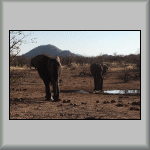 Photo BW-060 |
 Photo BW-061 |
On our way back to the camp, we saw an African Black Eagle and a
Red
Hartebeest. During the evening, a small herd of elephants passed
the camp.
Thursday, 22-Sep-2016
Today's two projects: Road Repair and Rubbish Removal.
Using an assortment of tools (axes, pickaxes, shovels and spades), this morning's (physical) activity involved removing rocks, boulders, tree roots and tree branches along the new road, through to the tarmac road, and then infilling the resulting holes and ruts. The intention being to make the ride less bumpy - and more comfortable! It was a very labour-intensive and perspiring couple of hours, especially as the sun got higher in the sky - and the heat increased. For the uninitiated (or inexperienced!) idiot of a Danish student, pickaxes are used for rocks, and axes are used for wood - not the other way around!
While we were geting ready to start the afternoon's Rubbish Removal activity, Judi arrived and asked if we could, instead, help her with water for the elephants. Yes, we could, and we did. We loaded appropriate equipment (including a petrol-driven water pump) onto the back of the Land Cruiser. One (unexpected) thing delayed us: we needed to go to Judi's new house to get some petrol for the water pump; nice house, even though the plastering and decorating was not quite finished. It has a lovely southerly outlook from the (to be) patio.
We set off for the first waterhole in Judi's Land Cruiser and Dicks driving the other Land Cruiser (complete with a 1,000 litre tank on board). Unfortunately, the waterhole didn't have enough water in it. To take a thousand litres out of it would deprive other animals of the precious liquid. Therefore, we drove to the Triple Pans waterholes. Unfortunately, the same situation was evident. Plan C was "Let's try the river" (Limpopo).
So off we set for the Limpopo River. Once we had arrived at the river, we started lowering the filling pipe down the high bank and towards the water. However, it became obviouse that the pipe was not long enough. Fortunately, the nearby Pink House (which was soon to be demolished) had a water supply tank. With a bit of effort, Dicks managed to carefully position the Land Cruiser so that we were able to transfer enough water into the tank on the Land Cruiser.
On our return to the camp, we passed the Triple Pans (waterholes), where a few giraffes were drinking; as can be seen in the next three photos. While we were watching them, a hyena walked into the area and the giraffes retreated! The hyena moved into the pool and, not only did it drink, it decided to take a bath (Photo BW-065)! Once it had finished, and left the scene, the giraffes (plus five zebras that had since arrived), returned to the pools and resumed drinking.
 Photo BW-062 |
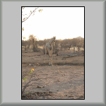 Photo BW-063 |
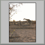 Photo BW-064 |
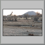 Photo BW-065 |

A Young Giraffe Drinking
[0 minutes, 28 seconds]
After leaving the animals to drink, we were passing a koppie/kopje when I spotted what I thought was a leopard behind a bush. "Stop!" I shouted! Judi reversed and switched on her search light. Sure enough, there was a leopard behind a bush (Photo BW-066)!
It turned its head and faced us, but unfortunately, no-one had a camera ready. However, I managed to take a second photo of it as it walked away (Photo BW-067), towards the koppie/kopje at GPS: S22°21'14.70" E28°53'40.90". Life, and this country, is full of surprises!
Back at the camp, we told and showed Estaban what he had missed by not coming with us! He wasn't very amused!
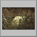 Photo BW-066 |
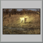 Photo BW-067 |
Today's two projects: Pump Installation and a Bird Census.
A test borehole (not far from the camp) had previously been drilled and a thick metal pipe inserted into it. This pipe had been closed by having its top cut into 'strips' and folded horizontally. This morning's exercise (as I understood) was to insert a pump into the pipe to ascetain the amount and quality of the water in the borehole.
The top 25 cm (approximately) of the pipe was cut off and a plumb line was lowered into it to 1) detect how far down the water level was from the surface and 2) ascertain the actual depth of the water. A length of black plastic tubing and a length of yellow electrical cable were cut to a length somewhere between the two measurments taken, so that the pump would be positioned mid-way within the underground water. To avoid any knots, the tubing and cable were laid out along the ground (Photo BW-068). [The Danish child imbecile started arguing. In the end, he stopped helping and went and sulked in the truck.]
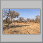 Photo BW-068 |
How would the pump work? Well, two solar panels were tied to the roof of an older vehicle. The solar panels provide the electricity to the pump via the electrical cable. Once the pump was in place, the power was switched on - and water began to flow nicely out of the black tubing. As elephants can smell water, branches and dead trees were arranged around the borehole pipe to protect it from being destroyed by elephants.
We finished at about 10:00 and returned to camp. Jens wanted to add more protection to the borehole, so he and I returned in the Land Cruiser (with the steering problem). After it was suitably positioned, we walked back to the camp. However, rather than walking back via the road/track, we went for a bush walk, and climbed two koppies/kopjes en route.
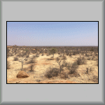 Photo BW-069 |
 Photo BW-070 |
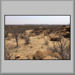 Photo BW-071 |
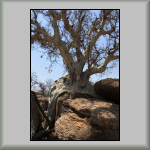 Photo BW-072 |
I can verify how easy it is to become disorientated in the bush. From the top of one of the kopies, Jens asked me if I knew where the camp was. I actually pointed in the opposite direction (even using the position of the sun)! In Photo BW-069, the white tops of a few of the camp buildings' rooves can just be seen in the centre middle distance. Photo BW-070 is a panoramic view from the top of the same koppie/kopje.
After admiring the view, it was time to descend the first koppie and climb another, closer to, and to the south of, the camp. In Photo BW-071, more of the actual buildings can be seen through the bushes. The particular Koppie that we were on had a Rock Fig Tree growing out of it (Photo BW-072) with an amazing-looking root system!
Although it was a windy day, it was hot on the tops of these koppies/kopjes (at 33°C), so it was a relief to get back to the camp for a top-up of much-needed water. We arrived at 11:30, just in time for lunch!
At 14:30, we set off to do a bird census. Click this link to show/hide the list of different birds species (in chronological order) that we saw along our route. View the route in Google Earth), we saw the following species:
Being Saturday, we didn't need to get up early. It was also Picnic Day, but today's picnic was with a difference. We left at 10:30 and Sophie drove us (via our constructed new road through the bush to the tarmac road) to the Motloutse River, near Motlhabaneng. The picnic spot was in the shade of a tree at the side of the dried-up river bed.
On the opposite side of the river was a rocky outcrop. Near its top were a number of bushmen rock paintings (Photo BW-073). The top of the mound provided good views to the west, upstream (Photo BW-074) and to the north-east, downstream (Photo BW-075) towards Motlhabaneng.
 Photo BW-073 |
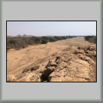 Photo BW-074 |
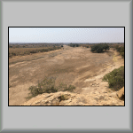 Photo BW-075 |
After leaving the picnic spot, we drove into the town of Motlhabaneng. We had a couple of refreshment stops before ending our visit at the Tsatsileeta Basket Group (Photo BW-076). We sat under a tree (Photo BW-077), where we were taught how to weave bracelettes from Lala palms (Hyphaene coriacea).
I was all 'fingers and thumbs', but fortunately, help was at hand! [Pun not intended!] This activity provides some vital income for the ladies. They are able to create numerous household items (table place mats, baskets, etc., etc.) whilst talking to each other! [It's a bit like those people who can knit, or play the piano, without looking at what they are doing with their hands!]
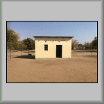 Photo BW-076 |
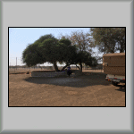 Photo BW-077 |
| Previous (Week 2) |
 |
Next (Week 4) |
Click to reveal a Home Page QR Symbol
![]()